

The Residential Map
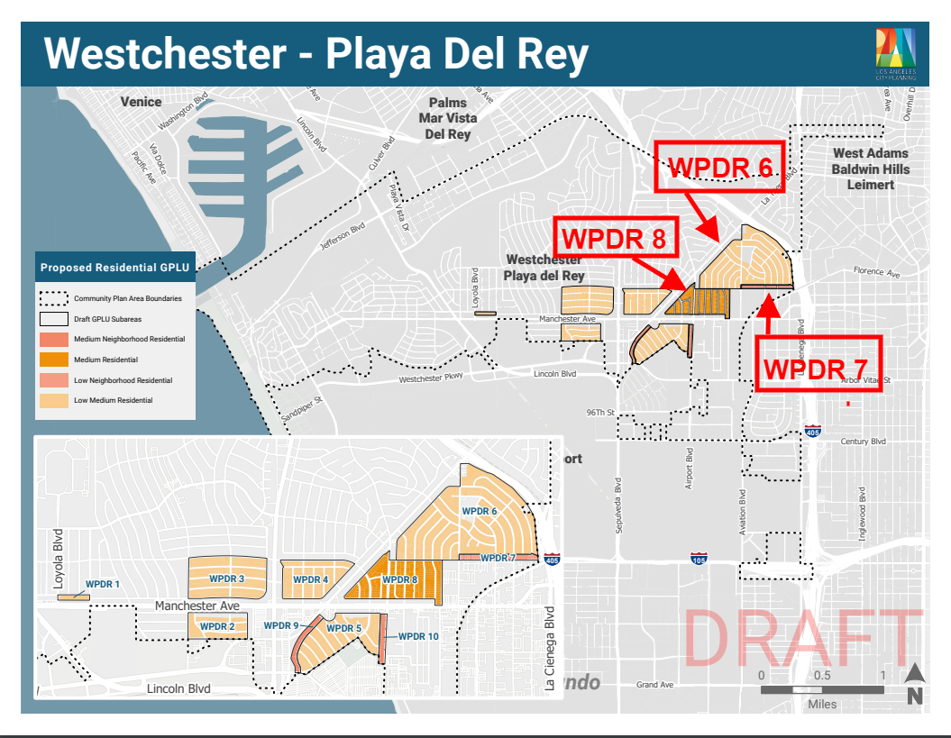
The residential map was apparently drawn with a new Manchester/Sepulveda TOC in mind, as well as the new Hindry light rail metro station. More has been written on the TOC here and the Osage commercial plan here.
Manchester/Sepulveda
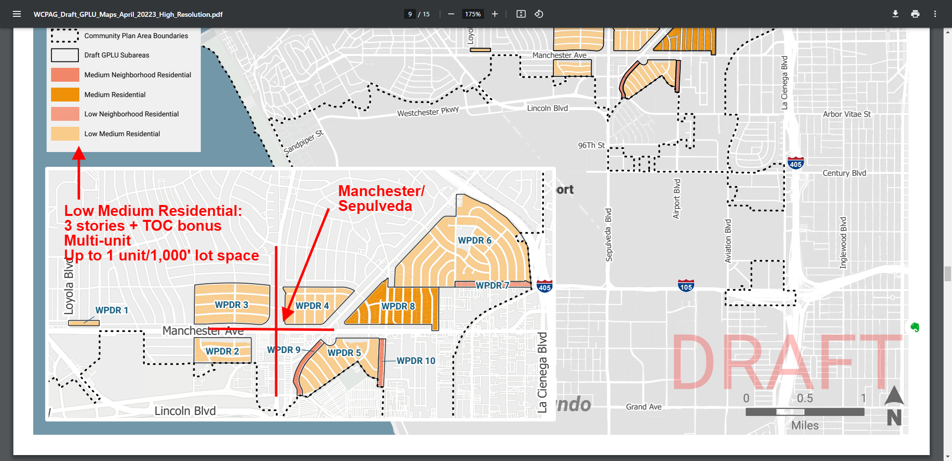
There simply is no way that we can allow Manchester/Sepulveda to be designated a TOC with all the density that brings. See City Planning Has Lost Its Mind. Is LAX Watching?
Osage
Osage has a light rail metro stop. There is no question that people without cars might like to live close to the stop. But how much is enough? See Osage Gets Slammed Again.
And you can’t even read the maps without multiple keys.
Residential Correspondence Table Key
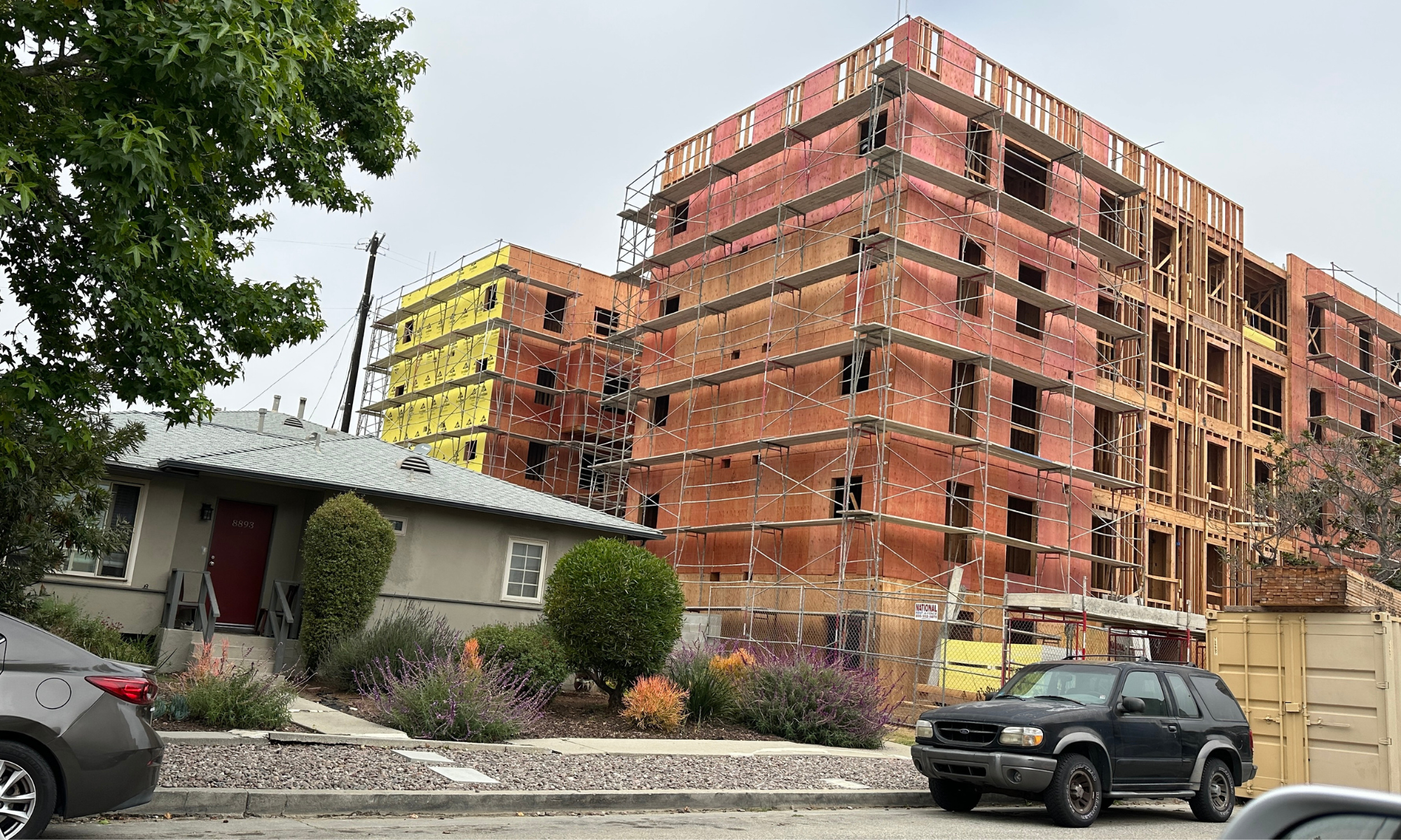
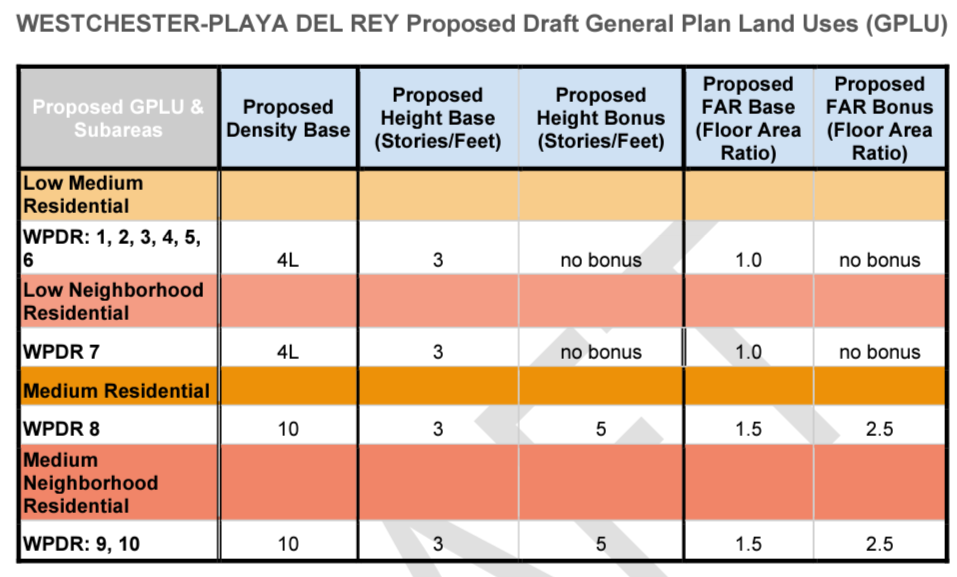
This key shows the proposed number of stories, among other data. So the density for Kentwood and Osage titled on the map as “low medium residential” really means 3 stories tall. The darker orange is up to 5 stories.
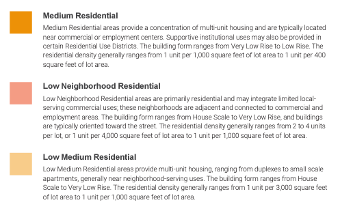
General Plan Land Use (GPLU) Designations
This key, excerpted from this table, shows that in Kentwood and most of Osage (WPDR 1-6), developers will be allowed to build 1 unit/1000 lot ft, or six units on the typical 6K’ lot. The dark orange in Osage allows 1 unit/400′ or 15 units on a 6K’ lot!
The bad news is really buried in the separate keys. That’s not annoying at all. 🙄
